

This part will tutor you to use SpatRain using the Java version. The basic principles are the same as the MSExcel version.
• Run SpatRain from your Program-Start Menu
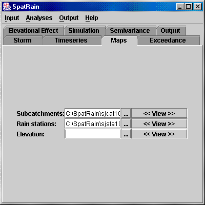
• In this exercise, we will generate homogenous rainfall over the area of Sumberjaya, Lampung, Indonesia. Go to Maps. Find file sjcat1000.map as the sub-catchments map and sjsta1000.map as the rain station map. Let the elevation map blank, since we won’t include elevational effect in this exercise.
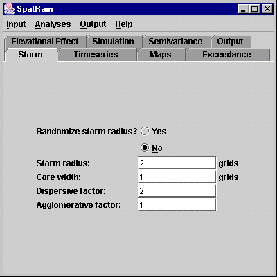
• Now, we should define our storm properties. Go to Storm. Since we want to generate homogenous rainfalls, we will make the core area of our storm relatively large (say: with the radius of 2 km and the width of 1 km), and the intensity distribution from the core spread relatively wide (say: with agglomerative factor of 1 and dispersive factor of 2). Do not randomize the radius to ensure that we will get large core area with above defined size.
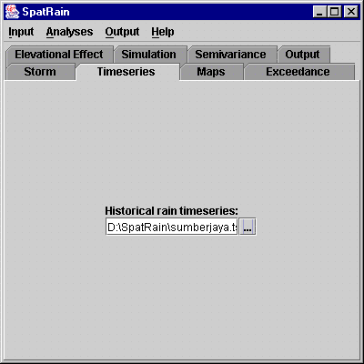
• Provide timeseries data of station level historical records from the area. Go to Timeseries, and select sumberjaya.tss.
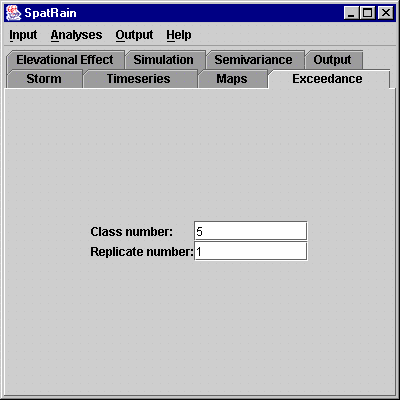
• Define number of classes and replicate to do exceedance probability calculation. Go to Exceedance. For this exercise, make the number of classes into 5, and just use 1 replicate
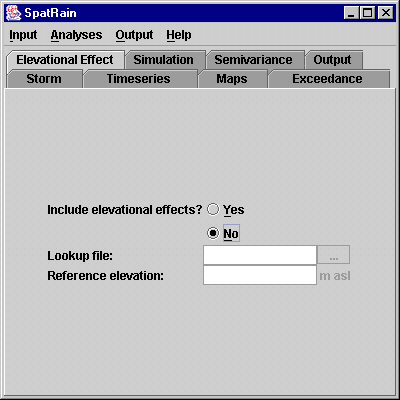
• Go to Elevational Effect and do not include elevational effects for this exercise.
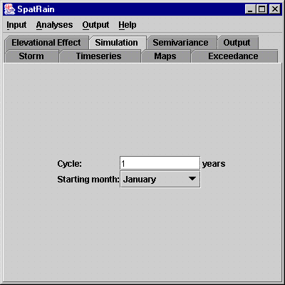
• We will simulate 1-year daily rainfalls starting from January in this exercise. Go to Simulation.
• Now, we should synchronize our storm characteristics with temporal pattern of historical records. To do that, select menu Analyses|Synchronize. Notice that our storm is not compatible with the station records.
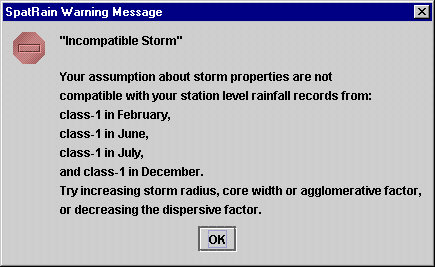
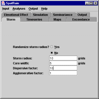
• Back to Storm. Modify the radius into 10 km, the width into 5 km, dispersive force into 10 and agglomerative force into 1. Yet, you should have compatible storm.
• You are now ready to generate rainfalls.
Select menu Analyses|Simulate.
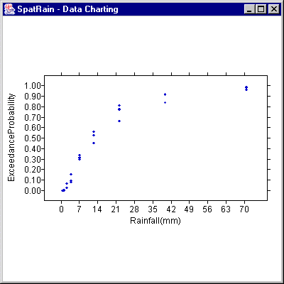
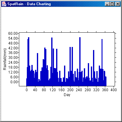
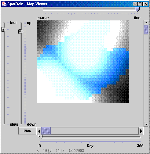
• You can see the results from menu Output, which are presented
as (1) Exceedance graph of actual rainfalls and simulated rainfalls at
cell, subcatchment and catchment levels; (2) simulated rainfalls at catchment
level as Timeseries; or (3) simulated rainfalls at cell level from the
whole area as Maps. You can get the results as tabular data from your
SpatRain directory: exc#.out for exceedance, sta#.out for simulated rainfalls
at station level, sub#.out for simulated rainfalls at subcatchment level
(as the input for GenRiver), and cat#.out for simulated rainfalls at catchment
level. The sign # refer to the output counter that can be found in Output.
This counter will automatically be updated every time you generate rainfalls.
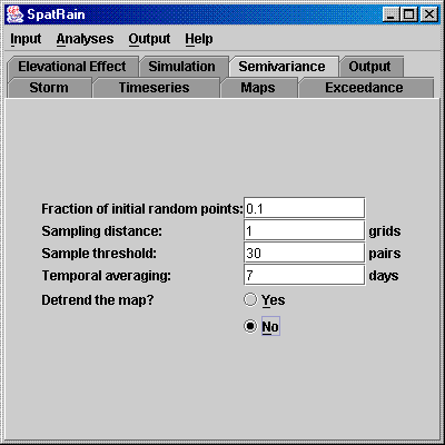
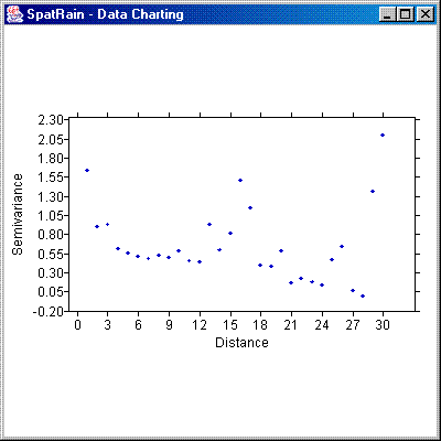
• To check how patchy your rainfalls are, you should do semivariance analysis. First, go to Semivariance. Make the fraction of initial random points equals 0.1, sampling distance equals 1 km, sample threshold equals 30 pairs, and temporal averaging equals 7 days. Do not detrend the map for this exercise. Once you have done with the above setting, select menu Analyses|Semivariance.
• To see the result of your semivariance analysis, select menu Output|Semivariogram or yu can get the results as tabular data from your SpatRain directory: sv#.out, where the sign # refer to the output counter that can be found in Output.
•
Repeat above procedures to generate patchy rainfalls. Afterwards, try
to include elevational effects. Also try to detrend the map in the semivariance
analyses.
• Notice that you can save your parameter setting by selecting menu
Input|Save... and load it again by selecting menu Input|Open...