 |
|||||||||
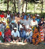
Watershed Planning
The focus group discussions utilized for watershed diagnosis led to the generation of a list of watershed problems, while the participatory ranking process served to prioritize these. Yet having "integration" as one of its key agendas, a piecemeal approach to addressing each identified issue was seen as inadequate and costly. Rather, functional linkages among discrete watershed issues had to be identified. While spatial and historical analyses provide an indication of how diverse landscape problems are causally linked, additional scrutiny of the issues by the site team was seen as advantageous for structuring research and development interventions. A planning tool for generating an integrated intervention strategy was developed by considering two parameters: a) the rank given to each watershed issue across diverse social groups, and b) functional linkages among oriority issues. The assumption was that by identifying issues having strong support across a range of local actors, and strong functional interactions (both social and biophysical) among the issues, future R&D efforts would have greater pay-offs as a function of broad social support and biophysical synergies. This approach is described in detail in the AHI Technical Notes Series No. B5, "Creating an Integrated Research Agenda from Prioritized Watershed Issues."
By far the most popular planning method among researchers has been a single watershed level planning event involving representatives of all villages in the watershed. While this approach minimizes the transaction costs (i.e. time spent in planning) for both farmers and researchers, it minimizes the number of participants who can realistically participate. Therefore, close attention must be given to who participates, and to mechanisms through which the larger community can contribute to this process. AHI is experimenting with getting more widespread representation within watershed planning fora by setting "terms of reference" of meeting participants (i.e. to plan on behalf of others) and structuring feedback and validation meetings between the meeting's participants and the broader watershed community. These feedback events enable not only more widespread participation in and understanding of watershed problems and solutions, it also enables more detailed planning than what is possible from a single planning event.
Another approach being tested in Lushoto benchmark sites is to plan for integrated interventions within micro-catchments. Efforts to foster positive synergies between system components (crops, trees, livestock, soil, water) at landscape level are both information intensive and heavily dependent on local negotiations. Working through pilot catchments is one way to test integrated innovations before trying to scale out to larger areas. For example, farmers in Lushoto identified three problems that can be best addressed through integrated interventions: soil erosion on hillsides (exacerbated through the use of metal roofing), burial of fertile valley bottom soils with infertile soil from hillsides (with dramatic effects on yields of cash crops), and declining water discharge from springs. These efforts can be jointly addressed through water harvesting from rooftops for domestic use, soil conservation measures and negotiation of by-laws to govern the drainage of water from hillsides. Lessons learned from pilot catchments will be used to scale out the approach to other areas of the watershed.
The final approach to planning has been based on the stakeholder concept, where actors with divergent interests or "stakes" come together to negotiate solutions of mutual benefit. The approach under development within AHI consists of identifying a watershed problem, identifying stakeholder groups (i.e. those perceived to be causing the problem, and those affected), and creating an opportunity for these stakeholder to come together and negotiate more optimal solutions to the problem so that neither party is overly affected. Thus far, stakeholder-based planning has been either applied or is currently planned to solve niche incompatibilities in agroforestry (to address the negative effects of certain tree species on springs, farm boundaries, roadsides and other landscape niches); to negotiate temporary restrictions on livestock movement so that trees and soil conservation structures may be established in outfields; to establish responsibilities for spring maintenance; and to negotiate drainage and connectivity of soil conservation structures between neighboring farms. |
|||||||||