An e-publication by the World Agroforestry Centre
ALTERNATIVES TO SLASH-AND-BURN: a global initiative

|
|
An e-publication by the World Agroforestry Centre |
|
ALTERNATIVES TO SLASH-AND-BURN: a global initiative |
|
|
West Sumatra field exercise Diagnostic field exercises BACKGROUND The purpose of the field exercise was to expose national and international consortium members of the Slash-and-Burn Programme to some of the socioeconomic and biophysical methodological tools available for site characterization. The field exercise was conducted over a period of five days. Three days were spent visiting farmers' fields in two agro-ecosystems (forest margins and degraded grasslands) and two days were spent at the Sitiung substation exposing researchers to biophysical measurement techniques and finalizing workplans for site characterization and research (see programme in the appendix). The techniques reviewed and used in the field exercises are summarized in table 1.
The field work within a village was done by teams. Each team usually comprised three persons, one of whom was able to serve as translator. Composition of the teams was changed daily to give each participant a chance to work with a number of different colleagues. Field exercises followed an iterative process, in which the key questions and hypotheses were adapted based on information gathered and insights obtained the previous day. The group conducted two days of field exercises in Sitiung V, at the end of which an understanding of some of the patterns and processes began to emerge. This allowed the group to start constructing simple systems flow diagrams to interpret the problems, constraints and possible research agenda for the site.
The group also visited a neighbouring traditional Minangkabau village and a degraded grassland site (Sitiung IV). This enabled them to observe and analyse several different types of land use in the area and identify some of the associated factors and constraints. Following is a brief summary of the field exercises. More detailed information will be presented in forthcoming reports of the ASB programme. During the exercises mornings were spent in the field. The groups assembled back at the experiment station in mid-afternoon to review and synthesize the information obtained that day. They prepared overhead transparencies and presented oral reports. These were discussed and synthesized during late afternoon plenary sessions.
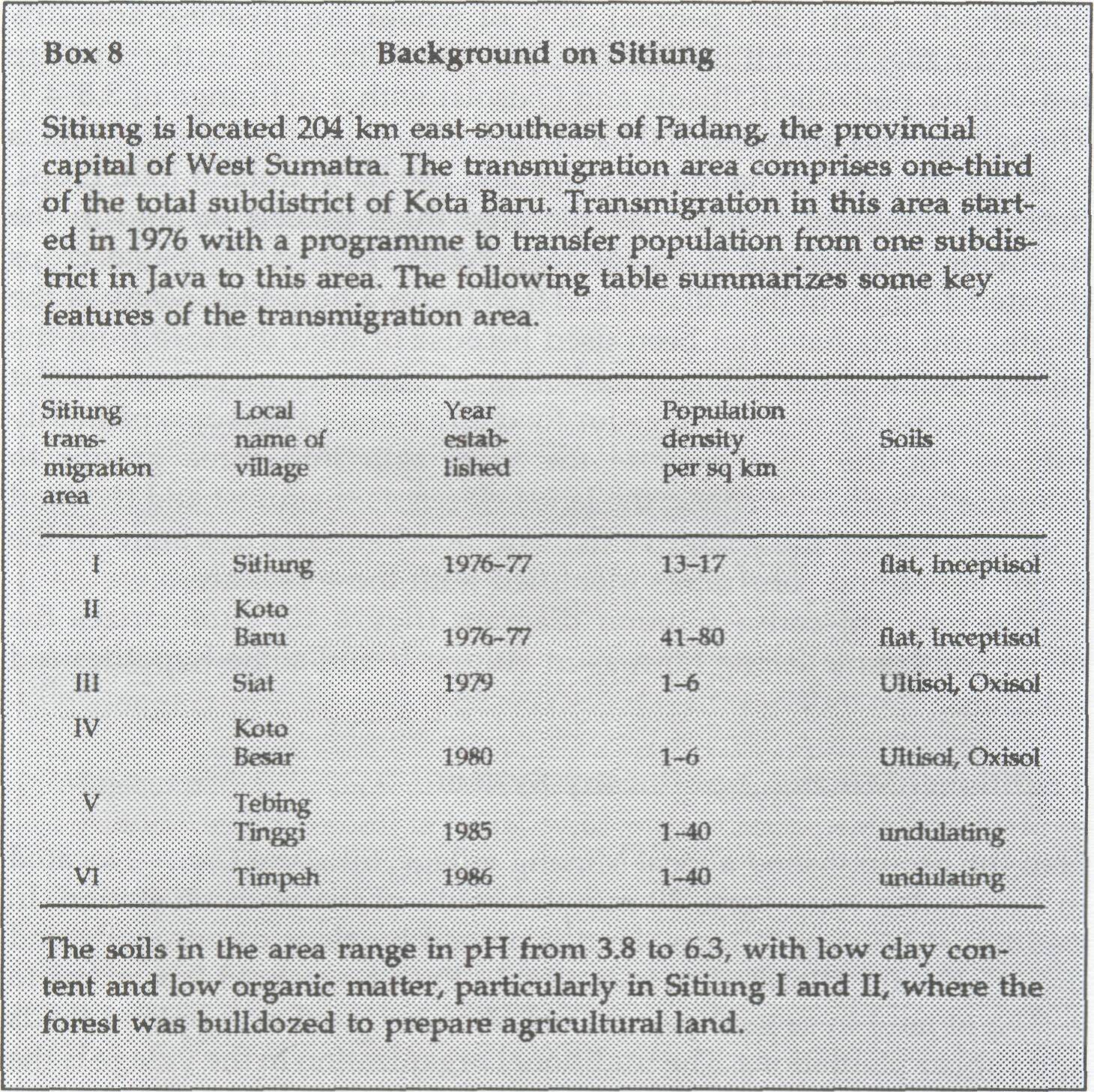
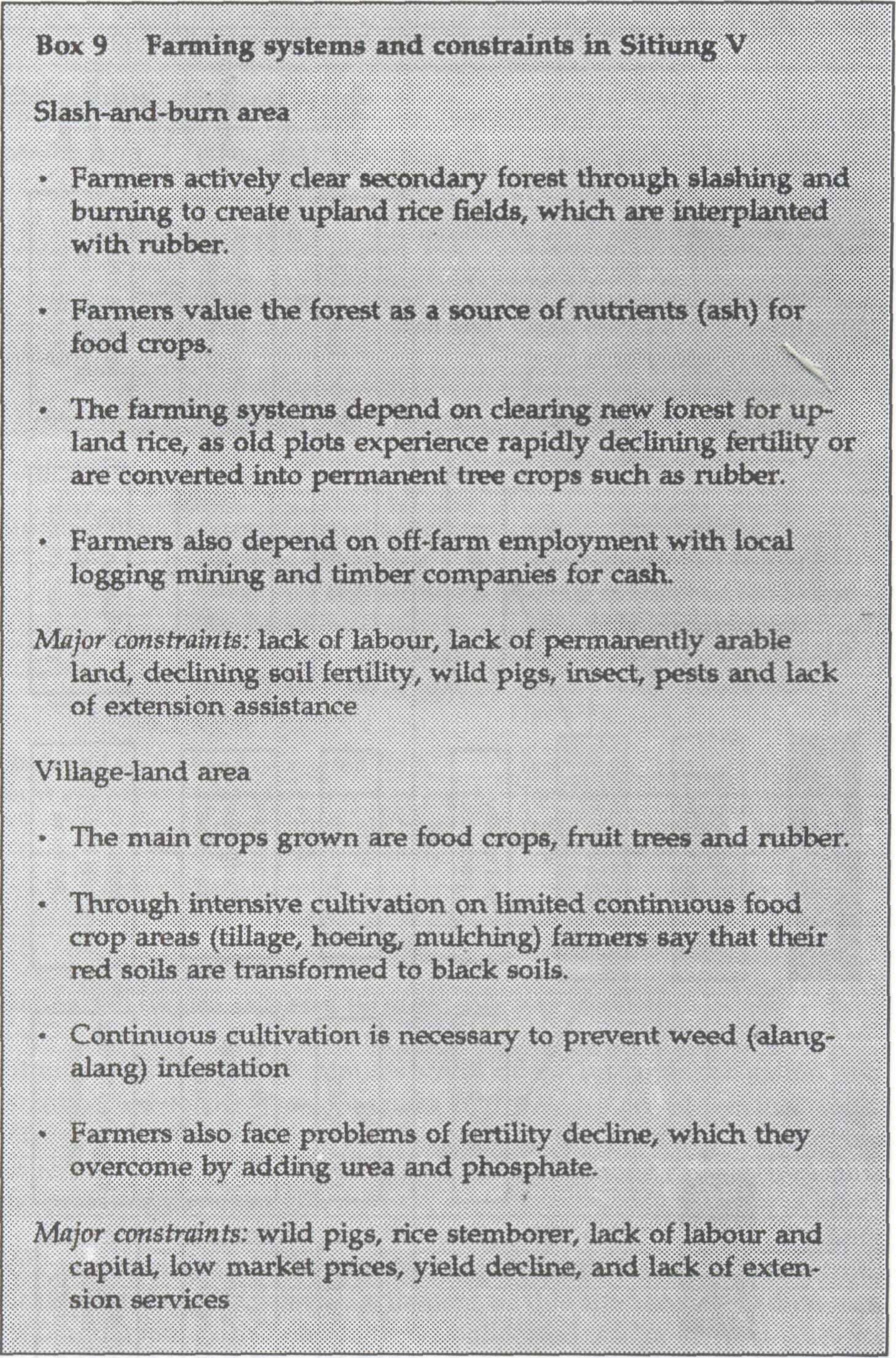
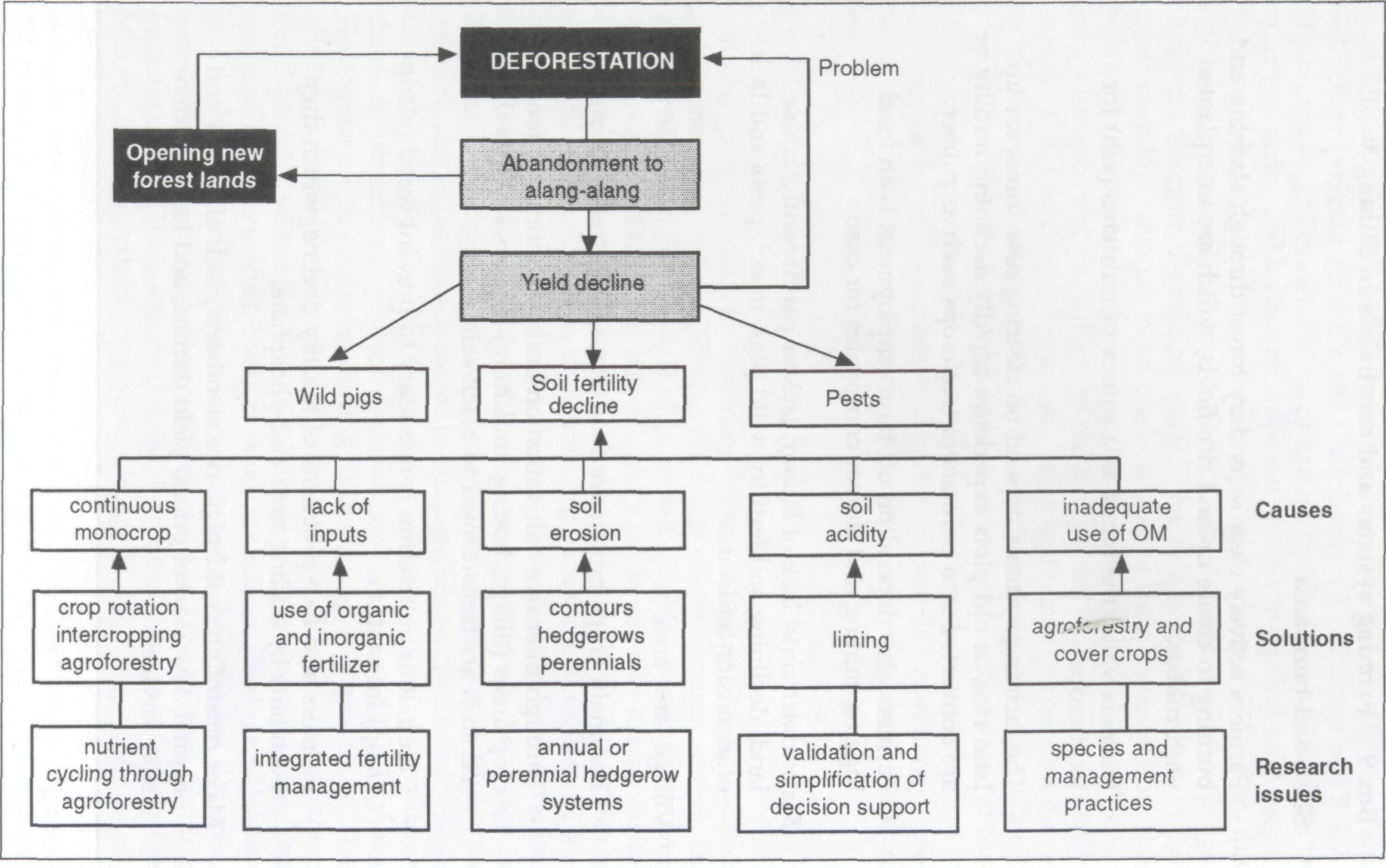
Sitiung V is located 7 km from the Trans-Sumatra highway and was established in 1985. The village consists of three neighborhoods of 100 households each (1350 people), 80% of whom are Javanese and 20% local Minang. Rainfall is 2500 mm per year. The soils in the area are red-yellow podzolic (Ultisols and Oxisols) with a pH range of 3.8-4.7. The village was allocated 700 ha of agricultural land, of which 75 ha is in irrigated rice, 250 ha in tree crops and 300 ha in upland food crops. Each transmigrant family was allocated three parcels of land in the following proportions: 1 ha for food crops, 1.25 ha for estate crops (located 1 km from the village) and 0.25 ha for a house lot. Many of the estate crop lots have not been used because of their distance from the village. Some of the villagers and other in-migrants are clearing forest on the boundary of the village for food crops and cash crops, primarily rubber. For the field exercise the team split into three groups to examine two distinct zones: the lands closest to the forest and the food crop area within the village settlement. Box 9 summarizes some of the major issues and constraints identified with these two areas. The problem-cause-solution diagram (figure 10) summarizes the major constraints facing farmers in Sitiung V and some hypothesized solutions.
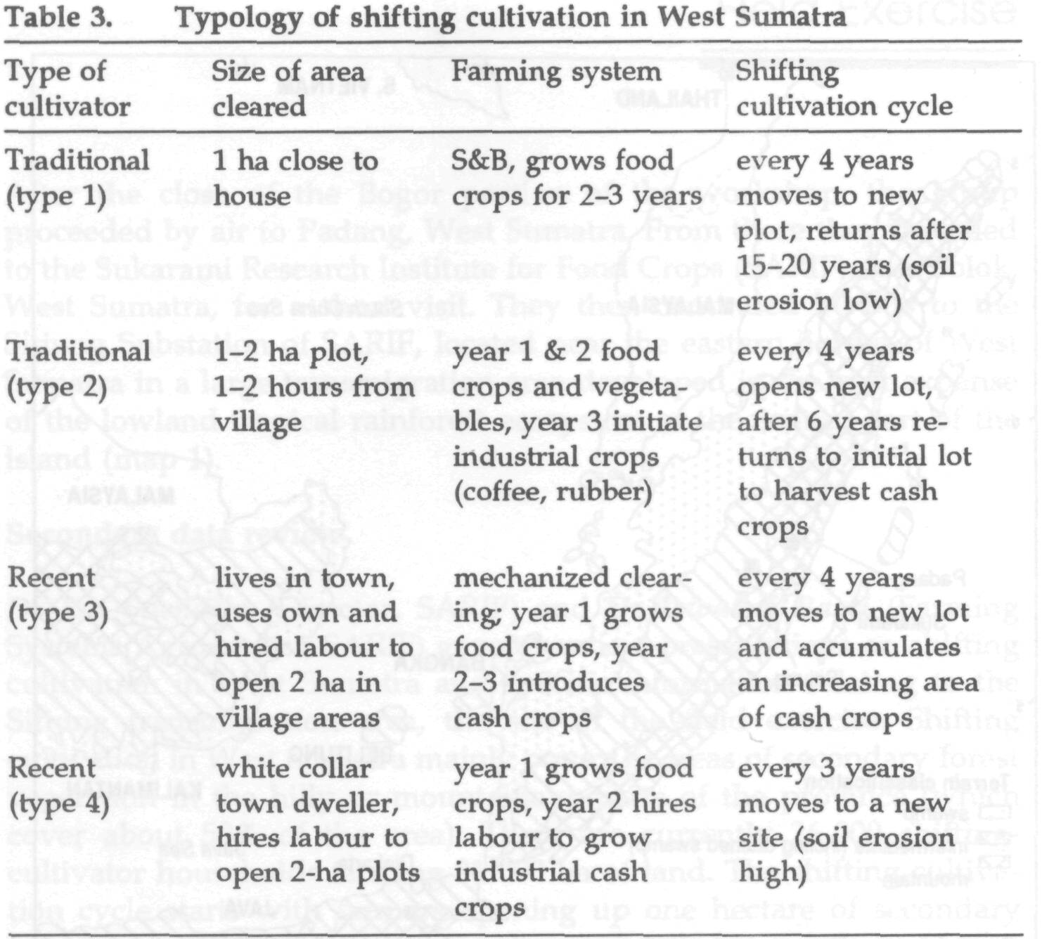
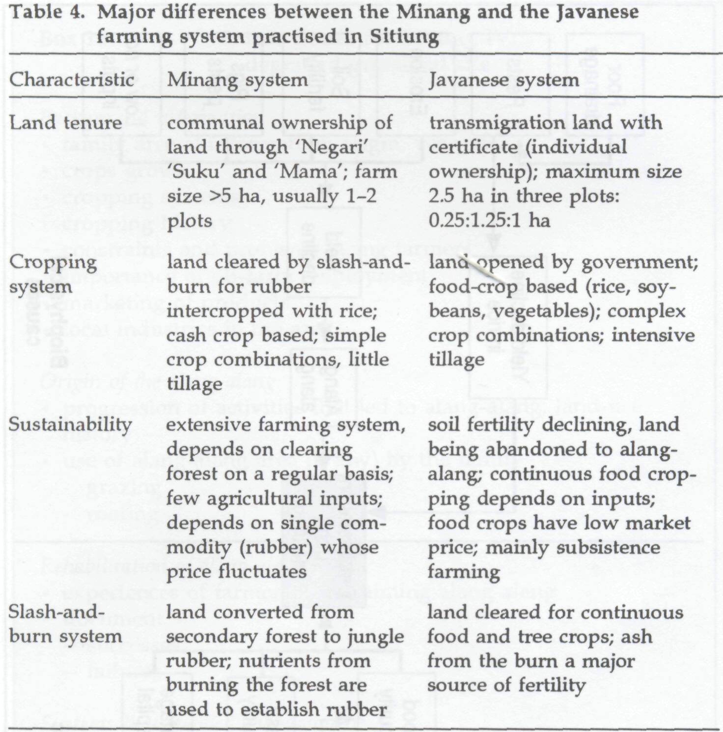
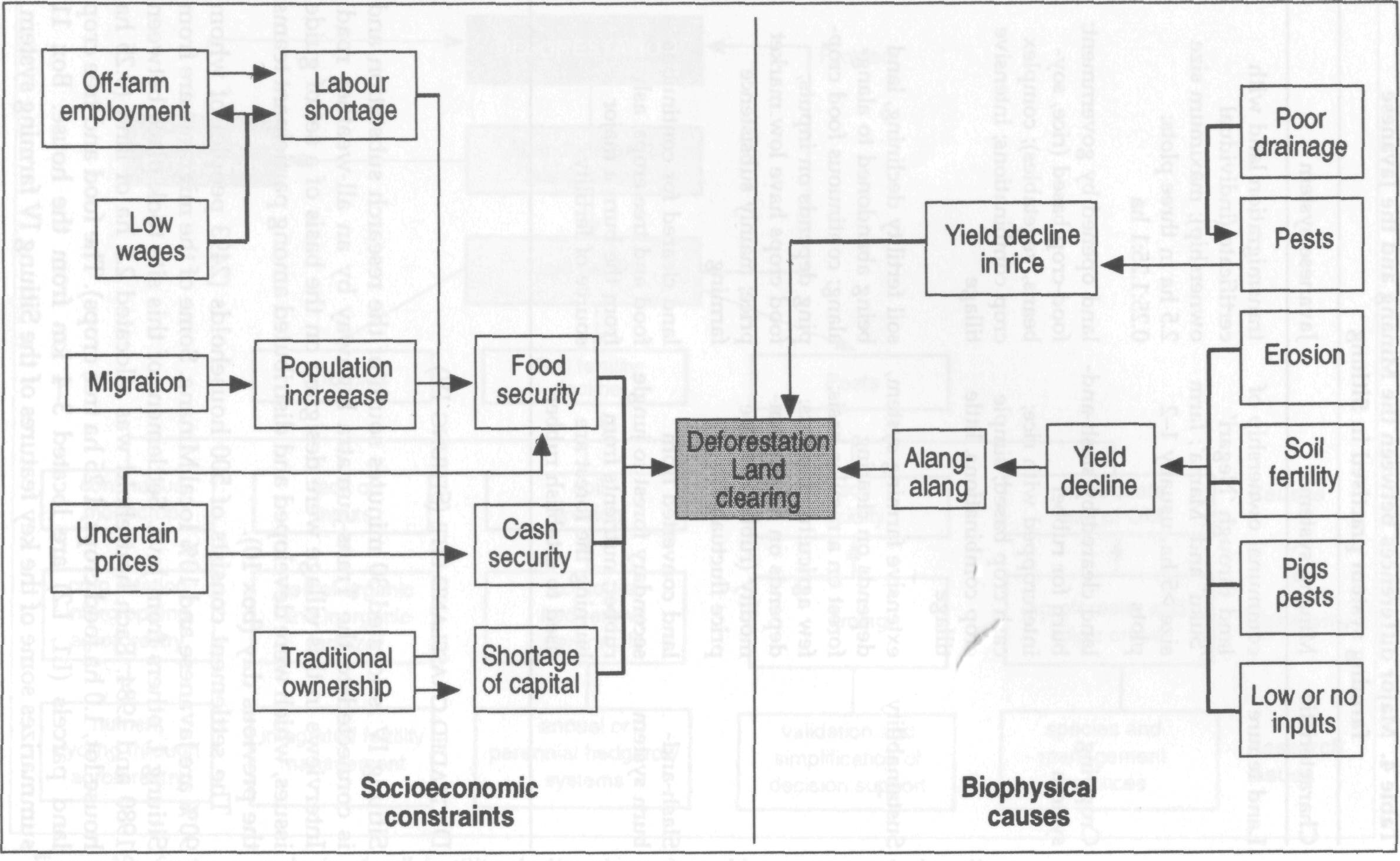
Half the group visited a local Minang village, Sikalang Gaung, located in Kecematan Koto Baru, 30 minutes south of the research station. In traditional Minang villages, land is owned by clans communally and user rights are allocated to individuals. Each household has access to 2-5 ha of land in several parcels including irrigated rice, upland fields and rubber plantations. The traditional organization in the village is the 'Suku' and 'Mama' (clan and subclan), who allocate land between Minang and outsiders. The traditional farming system in the village is based on converting primary or secondary forest (rimbo, bluka) to irrigated rice in lowland areas, or to ladang (upland rice fields). These are intercropped with rubber for 4 years until the canopy of the rubber closes. If rubber is not planted the ladang is abandoned for 2-10 years (Soso-Samak), after which the shifting cultivation cycle begins again. The Minang households also plant a large variety of fruit trees in their home gardens, which provide a useful source of food and income. The major constraints to the Minang farming system are shortage of labour and the build-up of pests such as leafhoppers in the irrigated rice area. Some of the differences between the Javanese and the Minang farming systems in Sitiung are shown in table 4. Some of the constraints in the Minang farming system are given in figure 11.
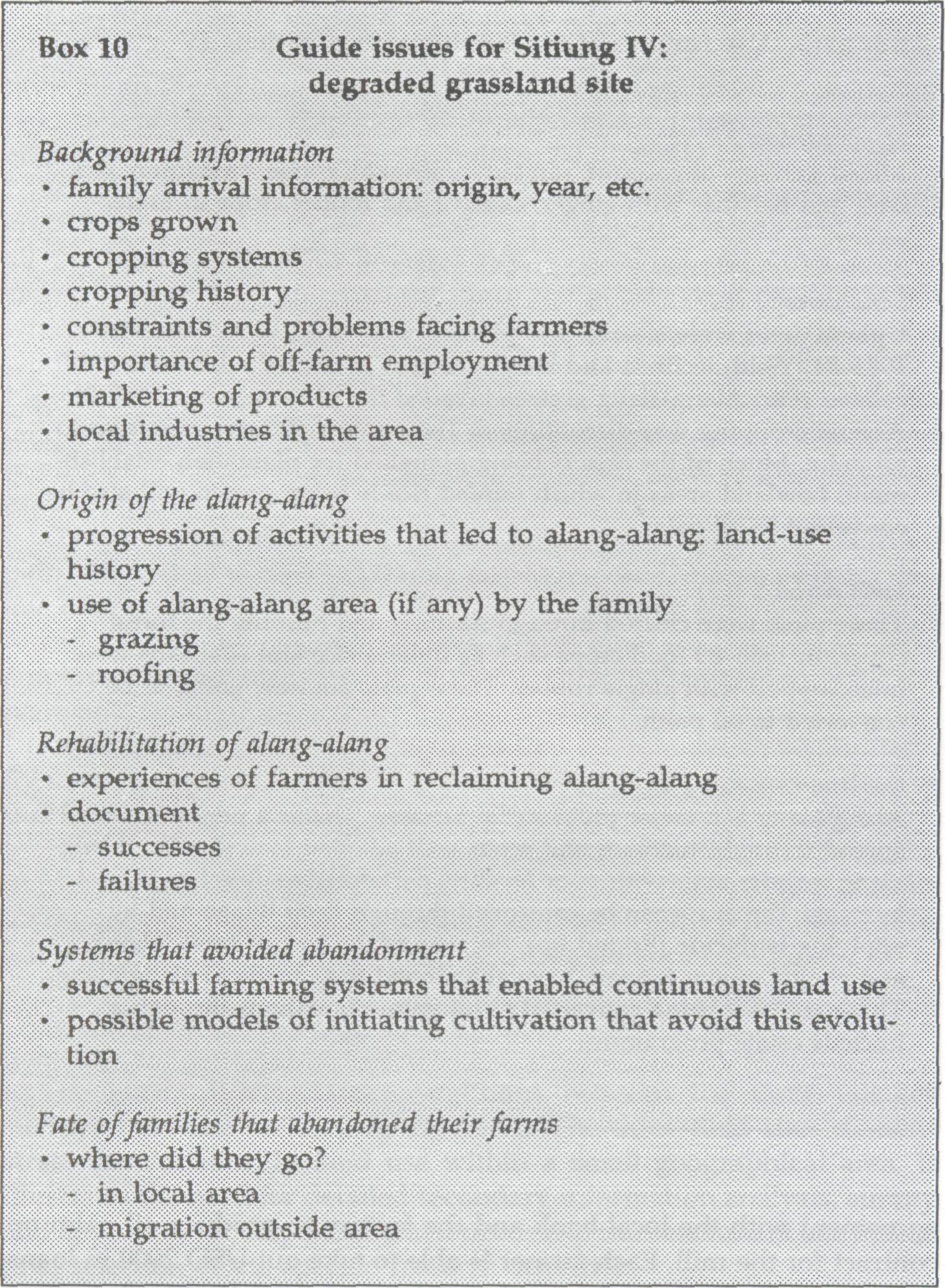
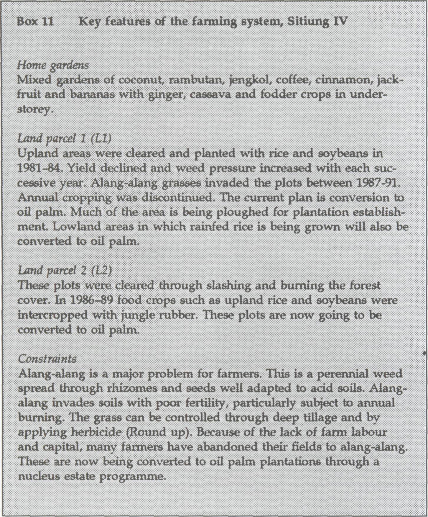
Sitiung IV is located 30 minutes south of the research substation and is connected to the Trans-Sumatra highway by an all-weather road. Interviews in this village were designed on the basis of a set of guide issues, which were developed and distributed among participant teams the previous day (box 10). The settlement consists of 500 households (2493 people) of whom 90% are Javanese and 10% local Minang. Some of the migrants are from Sitiung I, others from Java. Settlement of this site took place between 1980 and 1984. Each household was allocated 2.5 ha of land (0.25 ha house lot, 1.0 ha food crops, 1.25 ha tree crops). The food and tree crop land parcels (LI, L2) are located 3-4 km from the house. Box 11 summarizes some of the key features of the Sitiung IV farming system.
P.T Incasi Raya, a local company, has established a factory in the area to refine oil palm. The factory currently has 7000 ha in producing oil palm trees and a capacity of processing 400 t of palm kernels a day. Only half of the factory's present capacity is utilized, so local farmers in the area are being encouraged to convert their lands to oil palm cultivation. The farmer's cooperative in Sitiung IV has signed an agreement with the local bank and the factory to produce oil palm on contract for the mill. Each farmer is able to take out USD 2900 in loans to cover oil palm establishment and labour costs. Within 3-4 years these palms will start producing fruit. Under the current marketing arrangement, the fruits will be sold to the factory. The farmer will receive 70% of the proceeds in cash and 30% will go towards repaying the loan. The scheme appears attractive from a productivity point of view as a means of bringing the underutilized imperata grasslands of the village back into a major income-generating activity.
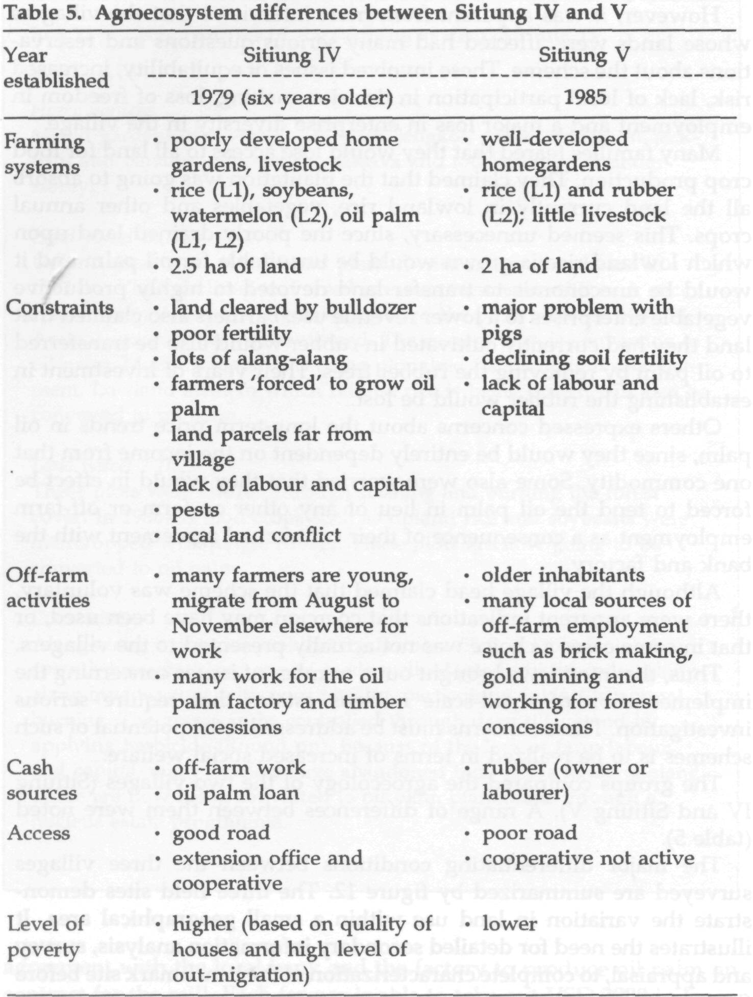
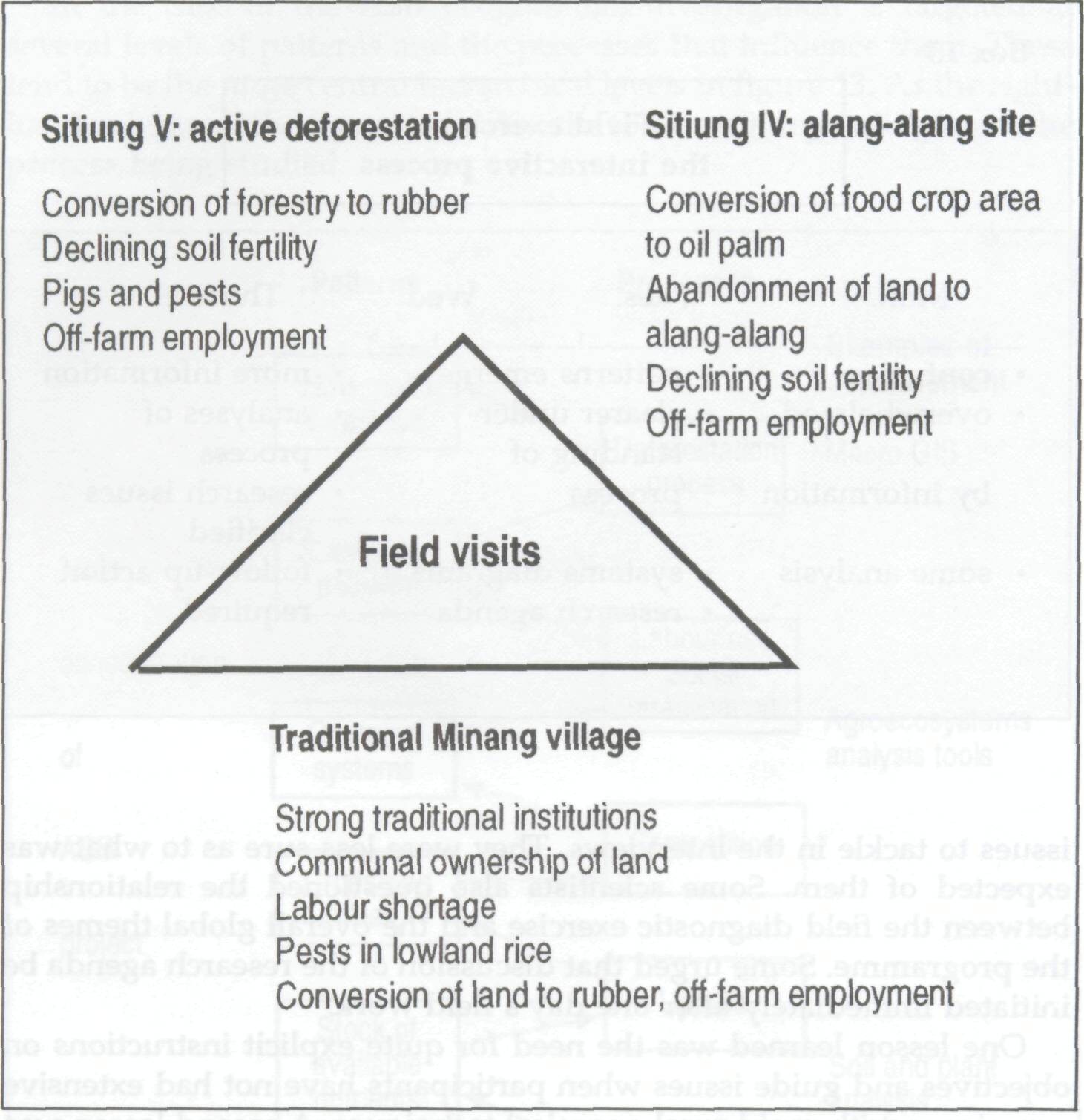
However, it was apparent from most interviews that the villagers whose lands were affected had many serious questions and reservations about the scheme. These involved issues of equitability, increased risk, lack of local participation in decision making, loss of freedom in employment and a major loss in enterprise diversity in the village. Many families feared that they would lose access to all land for food crop production. They claimed that the plantation was going to absorb all the land currently in lowland rice, vegetables and other annual crops. This seemed unnecessary, since the poorly drained land upon which lowland rice is grown would be unsuitable for oil palm and it would be uneconomic to transfer land devoted to highly productive vegetable enterprises to a lower revenue use. Farmers also claimed that land they had currently cultivated in rubber would also be transferred to oil palm by removing the rubber trees. Their years of investment in establishing the rubber would be lost. Others expressed concerns about the long-term price trends in oil palm, since they would be entirely dependent on the income from that one commodity. Some also were worried that they would in effect be forced to tend the oil palm in lieu of any other on-farm or off-farm employment as a consequence of their contractual agreement with the bank and factory. Although the village head claimed that the scheme was voluntary, there were apparent indications that coercion may have been used, or that in some cases a choice was not actually presented to the villagers. Thus, the interviews brought out a number of issues concerning the implementation of small-scale nucleus estates that require serious investigation. These concerns must be addressed if the potential of such schemes is to be realized in terms of increased social welfare. The groups compared the agroecology of the two villages (Sitiung IV and Sitiung V). A range of differences between them were noted (table 5). The major differentiating conditions between the three villages surveyed are summarized by figure 12. The three field sites demonstrate the variation in land use within a small geographical area. It illustrates the need for detailed secondary information analysis, survey and appraisal, to complete characterization of the benchmark site before final selection of the specific research activities.
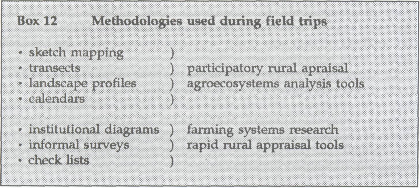
As the field exercises were completed the participants reviewed the process that they had followed. They listed the various tools that were used during the field trips and discussed their utility and suitability in light of the diagnostic knowledge needed (box 12).
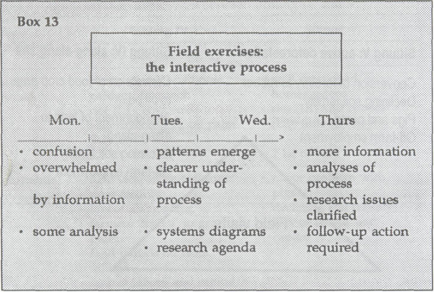
On the first day, in discussion on the iterative process of doing the diagnostic surveys (box 13), a number of participants expressed feelings of confusion. Groups with resource people experienced in diagnostic survey work engaged in vigorous interviews and immediately accumulated considerable insight. Groups without such resource people felt that more guidance was needed in interview methods and on specific issues to tackle in the interviews. They were less sure as to what was expected of them. Some scientists also questioned the relationship between the field diagnostic exercise and the overall global themes of the programme. Some urged that discussion of the research agenda be initiated immediately after one day's field work
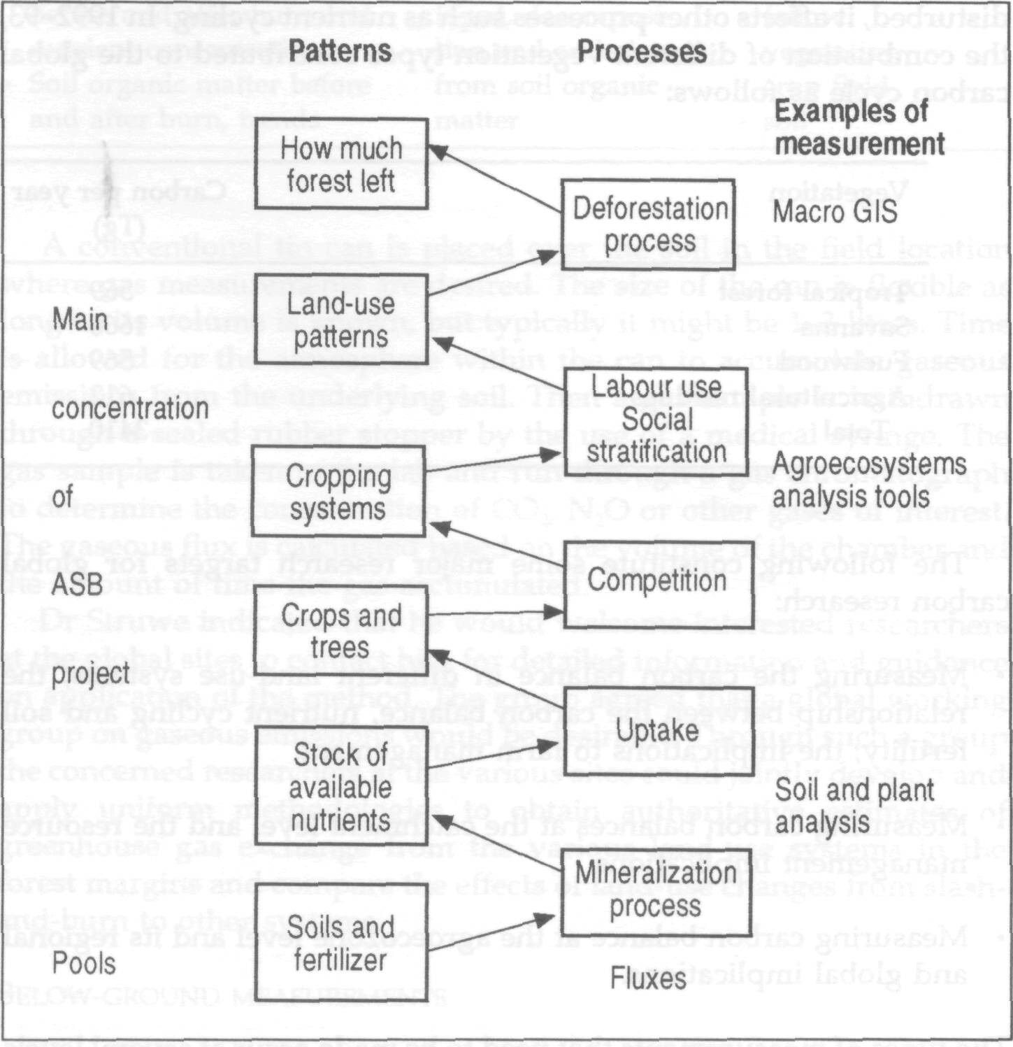
One lesson learned was the need for quite explicit instructions on objectives and guide issues when participants have not had extensive experience with rapid rural appraisal techniques. A second lesson was on the first day to use only informal open-ended interviews, delaying the plunge into using other tools such as transects and sketch mapping until the second day. After the second day, patterns were emerging and tentative summary diagrams could be constructed. Joint understanding of the processes began to solidify. By the end of the third day active comparative analysis of sites was under way and linkages with the research agenda were becoming clear. Dr Meine van Noordwijk discussed the issue of linking the various levels of analysis (figure 13). He proposed that the group consider that they were attempting to understand a series of patterns and processes, patterns being the outward manifestation of systems, the physical stocks of resources, and processes being the ways in which the stocks are changed. The processes are the unseen driving forces that control changes in the more visible patterns. In the case of the ASB programme, investigation is targeted at several levels of patterns and the processes that influence them. These tend to be the more central hierarchical levels in figure 13. As the right-hand column of the figure indicates, the tools vary depending upon the process being studied.
|