| | Upper Nyando Summary |
| | title | size | | extension | | category | author | dataset | hyperlink |
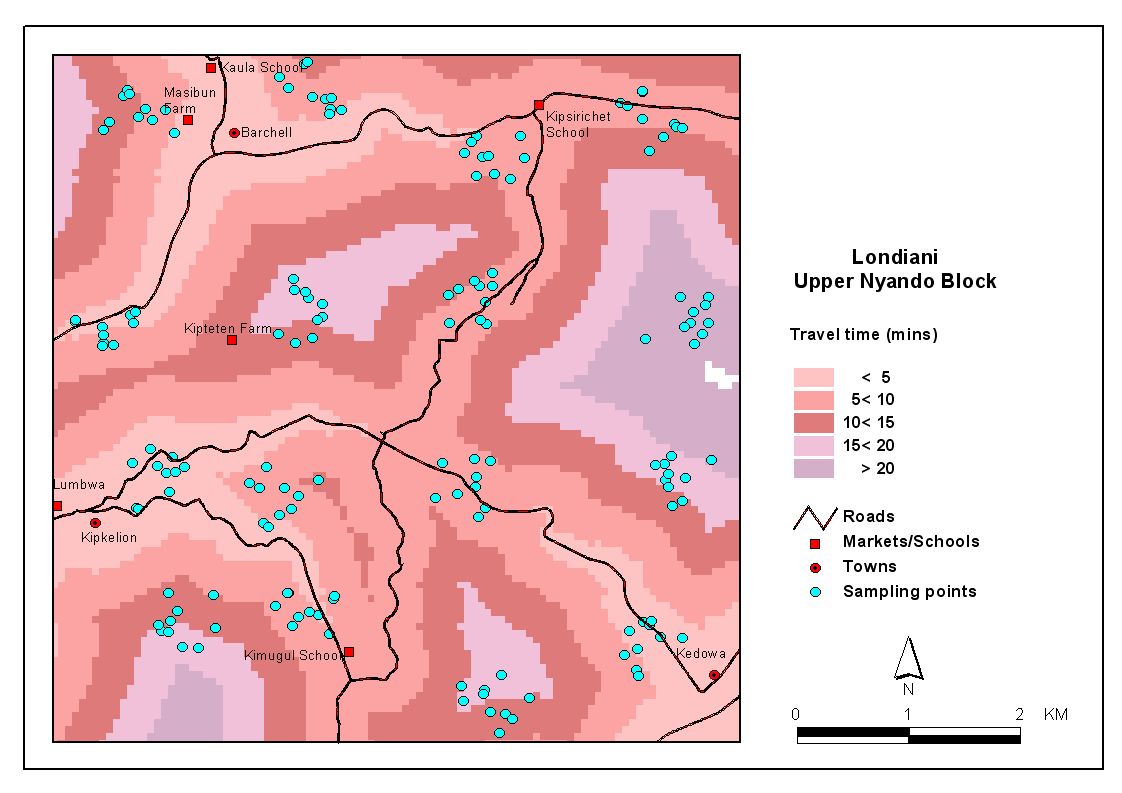
| | access map | 114213 | | jpg | | Execution | Verchot L. | Biophysical | view |
| | Biophysical survey database | 12505088 | | mdb | | Execution | Mango J. | Biophysical | view |
| | Computed Areas | 35328 | | xls | | Execution | Dietz J | Biophysical | view |
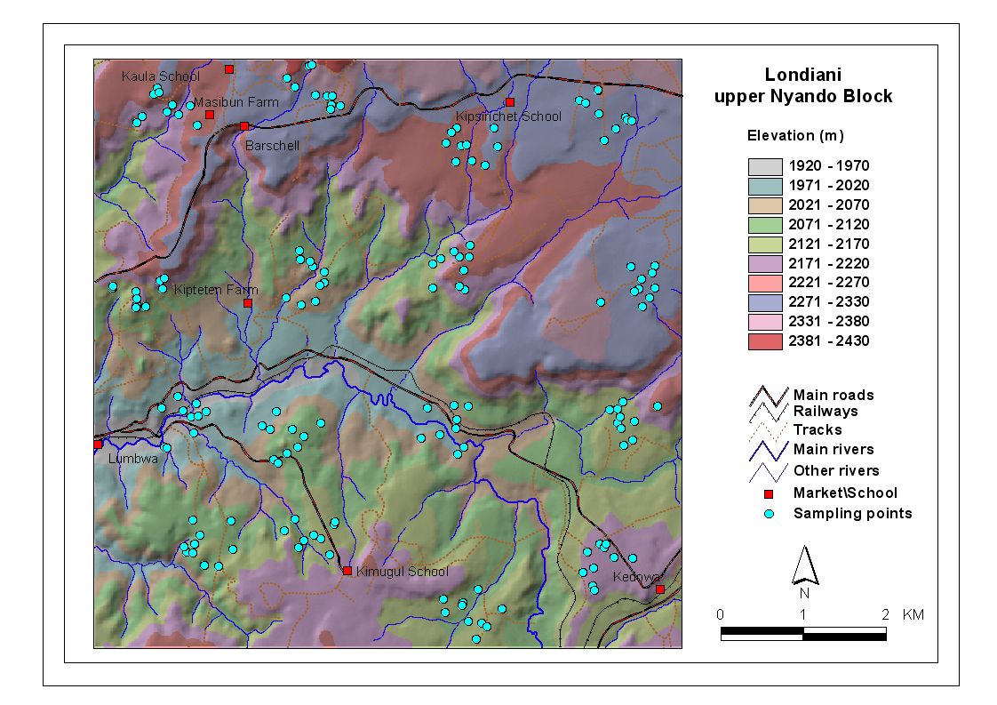
| | Digital Elevation Map | 172803 | | jpg | | Execution | Verchot L. | Biophysical | view |
| | Digital Elevation Map | 172803 | | jpg | | Execution | Verchot L. | Biophysical | view |
| | Land degradation risk Area_Computation final | 33792 | | xls | | Execution | Dietz J | Biophysical | view |
| | Land degradation risk map | 1475441 | | jpg | | Execution | Dietz J | Biophysical | view |
| | LDAF Assessment Sheet | 421376 | | xls | | Execution | Verchot L. | Biophysical | view |
| | LDAF Assessment Sheet | 413184 | | xls | | Execution | Verchot L. | Biophysical | view |
| | Londiani co-ordinates | 7606 | | txt | | Execution | Verchot L. | Biophysical | view |
| | Londiani co-ordinates | 7606 | | txt | | Execution | Verchot L. | Biophysical | view |
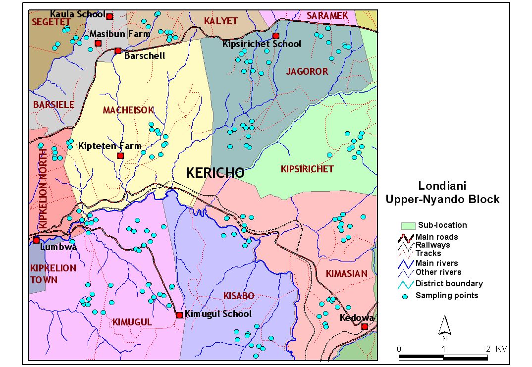
| | map for upper nyando | 186450 | | jpg | | Execution | Verchot L. | Biophysical | view |
| | map for upper nyando | 186450 | | jpg | | Execution | Verchot L. | Biophysical | view |
| | N2O and CH4 Kakamega data | 467456 | | xls | | Execution | Verchot L. | Gas | view |
| | N2O and CH4 Kakamega data | 467456 | | xls | | Execution | Verchot L. | Gas | view |
| | nyando upper boundary | 236 | | shp | | Execution | Dietz J | Spatial | view |
| | rainfall in Nyando Upper | 436 | | shp | | Execution | Dietz J | Spatial | view |
| | roads in nyando upper | 203980 | | shp | | Execution | Dietz J | Spatial | view |
| | Roads in Upper Nyando | 29193244 | | shp | | Execution | Dietz J | Spatial | view |
| | 12 August 2009 | Page 1 of 2 |